Mcleodganj to Triund winter trek
A winter trek to Triund is can be an easy or moderately difficult endeavour depending on the amount of snow that season. Triund is a 6-kilometre trek over a wide and well-marked trail. Nevertheless, a winter ascent comes with its share of challenges.
Table Of contents
Trek Diary
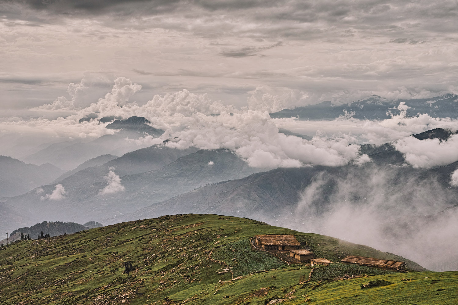
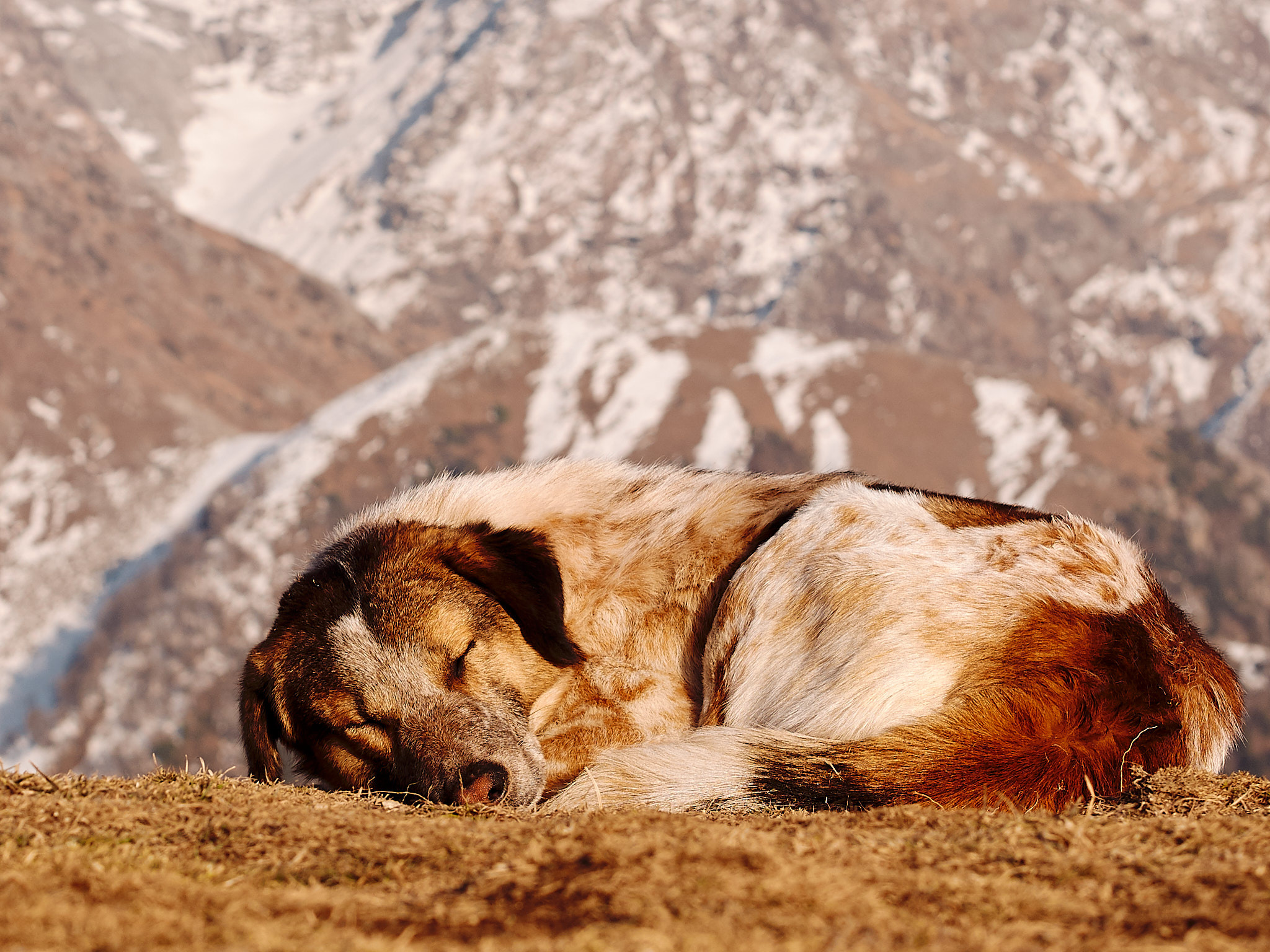
Despite its recent commercialisation, Triund remains the best vantage point for Dhauladhar gazing and peering over the Kangra Valley. This is especially true for harsh winters when we can have the entire meadow to ourselves. Situated at an elevation of 2810 metres, Triund is a long exposed ridge covered with grass and it is the best known day trek around Mcleodganj. Most travel web sites recommend visiting Triund during the summers but I digress. In January and February, it is not uncommon to have the place all to yourself and that makes this trek very lucrative in winters. Stargazing on a cold winter night is one of the best reasons for visiting Triund in the winters. Mun, Camel, Rifle horn, Two Guns, Slab and Dromedary Peak are just some of the peaks that dominate the skyline under a bright umbrella of stars on a clear night. The night also reveals the twinkling lights of the twin cities of Dharamshala and Mcleodganj.
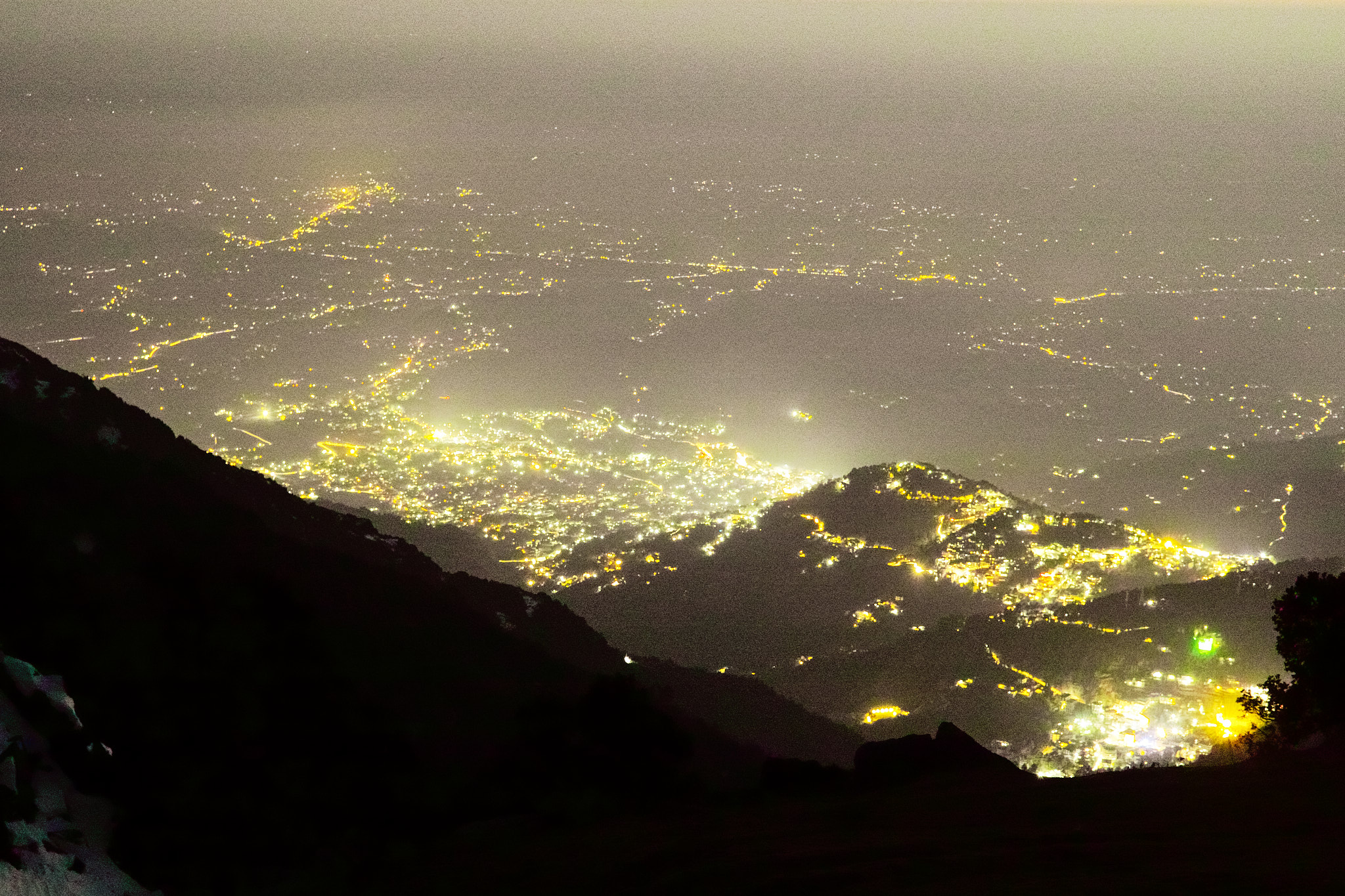
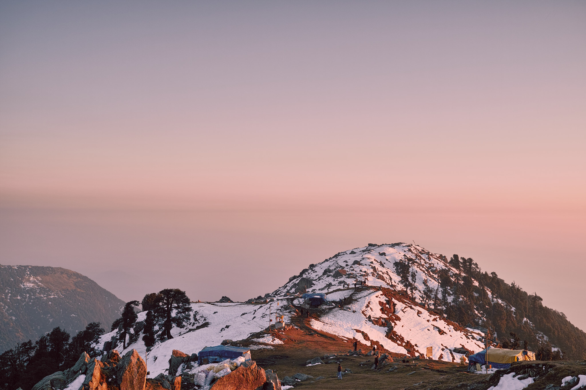
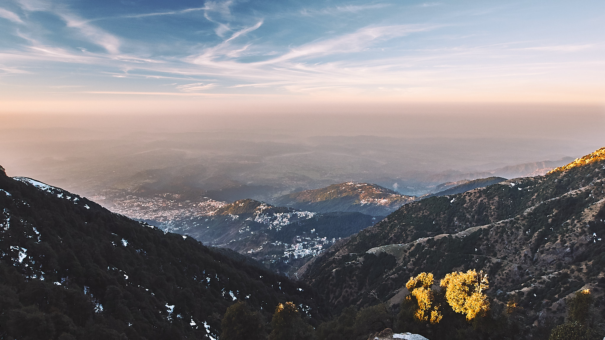
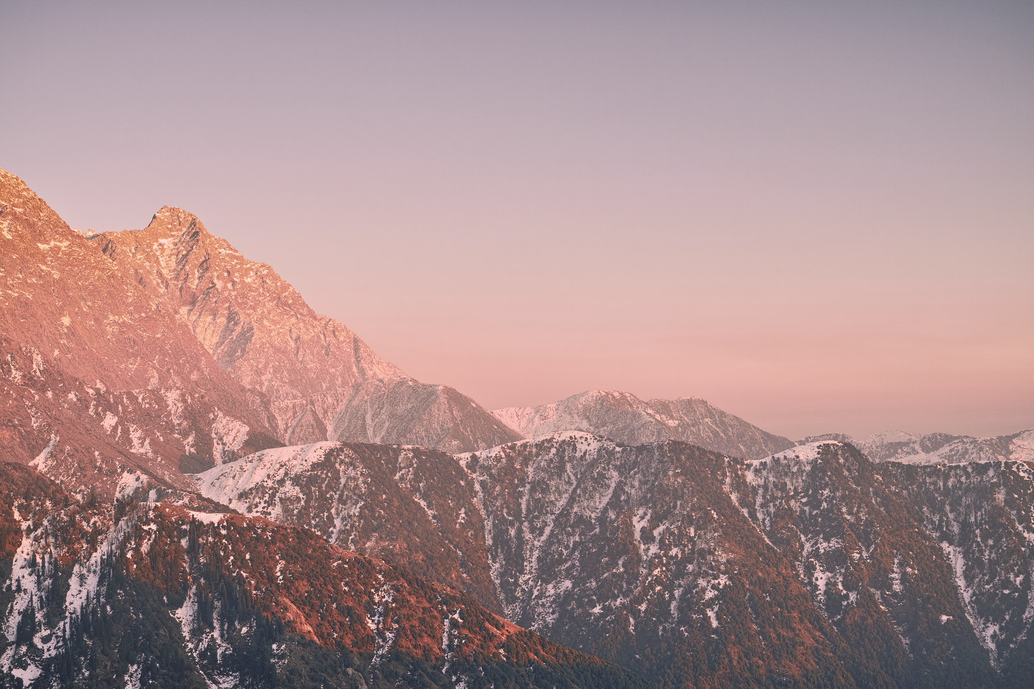
This winter has been very severe and January felt like the best time to visit Triund as it lay desolate and covered in a mantle of snow and ice. One tea shop en route and another one at Triund were still operational, while the others including the one at Snow Line had shut down because of snow and cold temperature. Nevertheless, the most memorable moment of this trek was watching the sunrise over the Dhauladhars and into the Kangra Valley. The early morning sun lights up the sky in mellow yellow, which changes to bright orange and then on to an angry red. The mist that envelops Kangra Valley parts like a curtain being drawn apart on a stage, and the valley shimmers and appears out of a hazy nothingness like a conjurer’s trick.
Trek Detail
The starting point for the 6-kilometre Triund trek is Galu Maheshwari temple near Dharamkot. The trail is a wide, well-marked and well-known mule path and there is no bifurcation en-route. Most of the trail catches the sun in the day and this keeps the trail relatively snow-free. Nevertheless, heavy snowfall can block this path for a day or two.
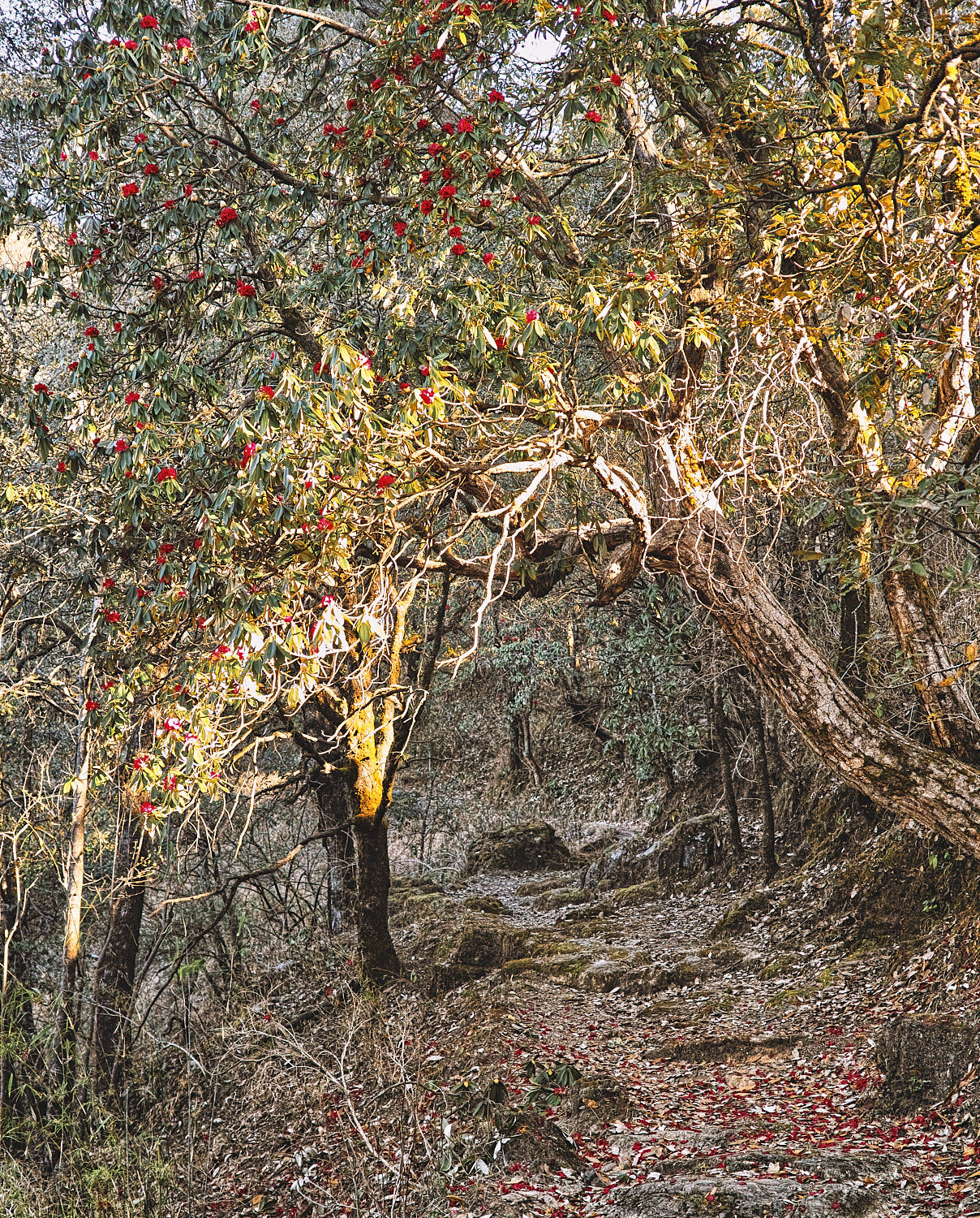
The trail starts with a gentle climb from Galu Maheshwari Temple till café Magic View. The café is rightfully named because of the beautiful view it affords over Kangra Valley. This café is halfway in terms of distance but it is almost a third of the way in terms of effort. After Magic View café the climb gets a tad steeper and it ends in a steep one-kilometre stretch through a forest of Deodars and Rhododendron. This final stretch through the woods is known as 22-curves, because of the 22 switchbacks that one has to climb to get to Triund. A word of caution though; this last kilometre of wooded section receives no direct sunlight and therefore snow turns into ice along the path which can get very slippery. Be careful on this section of the trail especially during early morning descents. This is when the ice is at its slipperiest.
Tip - Shoes for Triund Trek
As with most trails in Dhauladhars, the route to Triund is rocky and cut as steps. Boots with relatively stiffer soles fare much better over these rocky trails. A stiffer sole means less foot fatigue over rocky terrain. Before buying new shoes/boots, check it’s sole stiffness. Bend the shoe along the sole, with the toe-box pressed to the ground. The shoe that flexes more, is less stiff. Choose a boot or shoe that flexes less yet is not completely rigid.
Trek Summary
- Type - Day Trek. Easy (3-season) to moderate (winter snow).
- Difficulty - Swiss Alpine Club (SAC) Scale - T2.
- Trek Duration - 2 – 3 hours ascent 1.5 – 2 hours descent (from Galu Temple). Add an extra 1.5 hours if starting from Mcleodganj Bus Stand.
- Trek Distance - 5.5 kilometres from Galu Temple, 10 kilometres from Mcleodganj bus stand.
- Maximum Elevation - 2810 metres.
- Start and End Triund Trek - Galu Maheshwari Temple near Dharamkot
- How to reach Triund - Buses ply regularly to Mcleodganj from Dharamshala. From Mcleodganj one can make an easy walk to Galu Maheshwari Temple near Dharamkot. You can also rent a taxi/auto-rickshaw at Mcleodganj bus stand to ferry you to Galu Temple. Taxi charges 200 to 400 rupees one way (2015) between Mcleodganj bus stand and Galu Temple.
- Hotels & Stay - The stay options in Triund have increased recently. The oldest structure is a forest guest house which can be booked in Dharamshala. The booking office lies behind Park Restaurant opposite to Dharamsala Police Station and General Post Office. Another privately owned guest house with two rooms is run by a tea shop owner. A room at either of these guesthouses cost around 500 rupees/night. You can rent a tent and bedding at tea shops in Triund. If you are feeling adventurous, a couple of caves to the South end of the ridge offer free accommodation. However, this winter we recorded a minimum temperature of minus 5 degrees C at night (with windchill), so it is better to keep an eye out for the weather and be prepared.
- Weather - Pleasant during the day, if it is sunny. Below zero degree C at night in December and January. Could go as low as -9 with windchill
- Water - No water source en-route or at Triund. The tea shops charge 50 rupees for a bottle of water. If you are on a limited budget its best to carry your water and eatables.
- Caution - It gets cold (-5 degrees C) at night in winters. If you plan to bivouac at one of the caves, make sure you are adequately prepared.
GPS Map, Waypoints & Log
Related
- Triund trek route as an interactive map. Move your mouse pointer/finger over the elevation chart in the bottom right.
- Triund to Snowline Cafe with GPS route.