Irshalgad plateau and tower monsoon trek
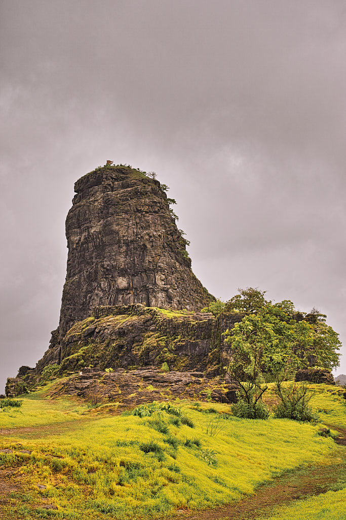
No road link, a secluded village, beautiful vista and a less often used trail makes trekking to Irshalgad feel like rediscovering a long lost civilisation. Irshalgad is an oft-ignored pinnacle located on a plateau that towers over Chowk town on the Panvel – Karjat National Highway NH4.
The 3.4 kilometre, 2-hour trek to Irshalgad is an easy, child-friendly trail. Nevertheless, this easy trail enchants with some magnificent views over Morbe reservoir , Prabalgad and Matheran plateaus. We rate this as the most beautiful yet easy treks in and around Karjat.
Table Of Contents
Trek Diary
A monsoon day trek to Irshalgad offers a lot to the aspiring trekker. The route is dotted with many viewpoints over Morbe reservoir. At sunrise, the water in the reservoir glints like orange shards as it reflects the pale early morning sunlight.
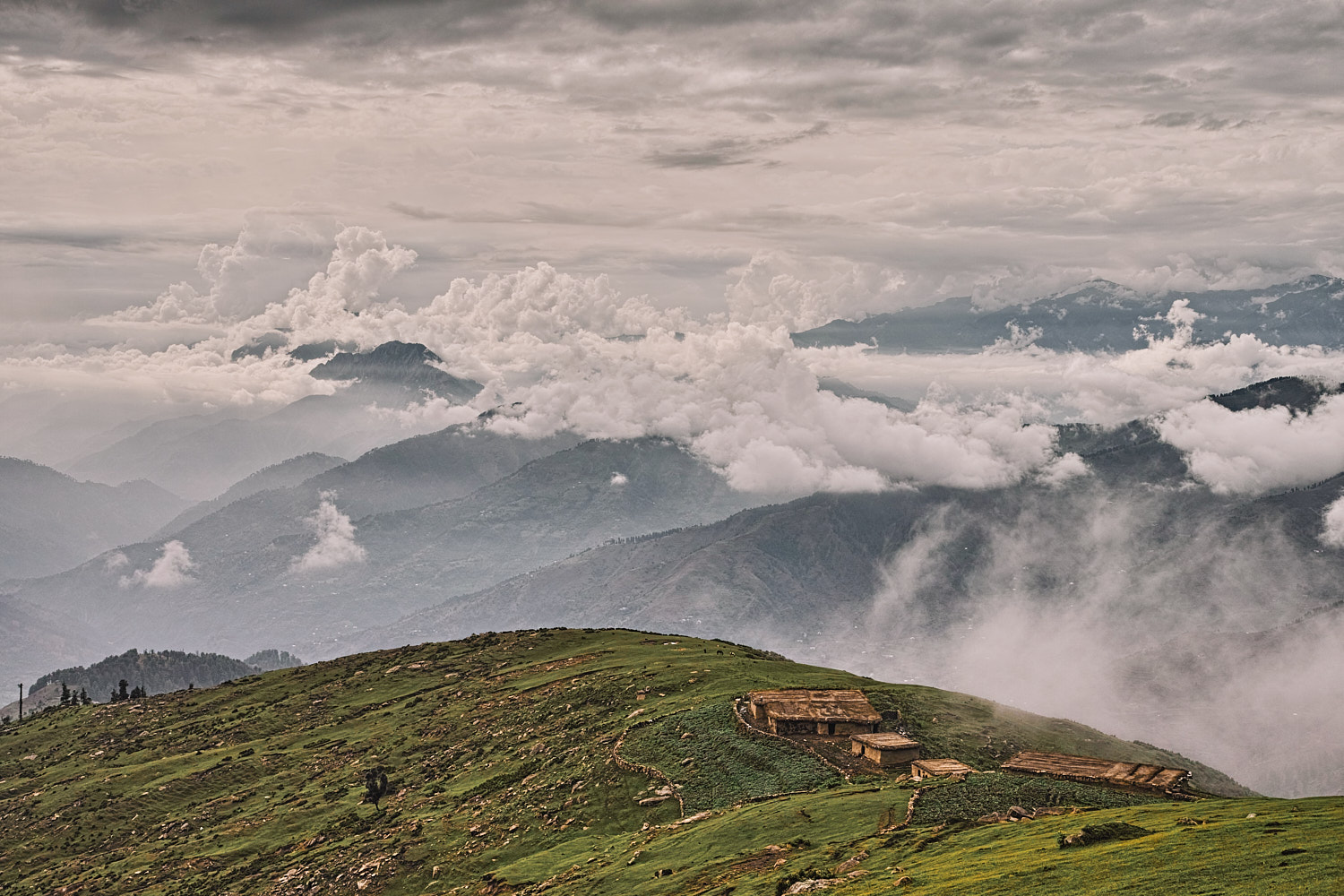
During monsoons just beyond the reservoir, Matheran plateau often plays hide and seek with the rain clouds. Monsoon season is the perfect time to enjoy this trek. The grass along the slopes is lush green and it sways gently with the wind and the green fields make an excellent contrast against the deep red earth of the plateau. The pinnacle is often draped in clouds and it adds to the seclusion and charm of this place.
I came across a lot of wildlife on my trek including grey langurs, bushy-tailed mongoose and even a large snake which I later identified as Dhaman or a non-poisonous common rat snake.
Trek Detail
If you use public transport, then you start your trek at Chowk town between Panvel and Karjat. Chowk is 19 kilometres from Panvel and 12 kilometres from Karjat on National Highway NH4. Buses and auto-rickshaws plying between Panvel and Karjat stop at Chowk. Chowk also has a small train station and the weekly Pune – Bhusaval Express (Train number 11025 / 11026) halts at this train station. From Chowk, an easy 2.5 kilometres walk due north brings us to Karja village. On the northern edge of the village, a water plant and an overhead water tank are visible. The paved road ends at this water tank which makes it our car-park and the starting point for this trek. From the water plant, cross a shallow stream and follow a wide, well-used mud trail that heads due north. The first 500 metres of this trail is flat and this brings us to the base of a ridge. The ascent from the base to the top of the ridge the path zigzags across the south face of the ridge.
Pace your self on these zigzags and enjoy matchless views over Morbe reservoir to your right. To your left the ridge slopes into a lush sea of grass. The ridge links Karja village with a small hamlet called Irshalwadi on the Irshalgad plateau’s shoulder. After the urban sprawl of Mumbai, exploring this hamlet feels like you have stepped back in time. The “kutcha” houses are made of mud and fibre and draped with mud baked tiles. The lanes are unpaved and children and chickens gawk and run between these lanes.
From the village follow a trail to your left on to a temple dedicated to a local deity. The approach to the Irshalgad pinnacle and plateau lies due west. Therefore from the temple, we follow the trail that leads west almost parallel to the Irshalgad plateau. 700 meters from the temple the approach to the Irshalgad plateau opens up. Climb and double back across a small unprotected climb to the base of the Irshalgad pinnacle. This small section where you climb on to Irshalgad plateau is a little steep and requires a bit of care. From the plateau, it is an easy walk to the pinnacle base.
The Irshalgad pinnacle can be ascended without the need for fixed protection. Nevertheless, we do not recommend this climb, especially during monsoons. In recent years, a few climbers have died due to overconfidence or a lack of protection.
“ Netaji Palkar, the second Sardar Senapati or Sarnaubat (Commander-in-Chief, Duke) of the Maratha Kingdom under Shivaji was born in Chowk village
Trek Summary
- Type - Day Trek. Easy and child-friendly (without pinnacle climb).
- Difficulty - Swiss Alpine Club (SAC) Scale - T1.
- Trek Duration - 2 hours ascent and 1.5 hours descent.
- Trek Distance - 3.4 kilometres one way.
- Maximum Elevation - 510 metres / 1673 feet
- Start and Finish - Karja village near Chowk town.
- Getting To Chowk town - Chowk town lies on NH4 that connects Panvel with Karjat. Chowk also has a train station (Station code CHOK ) . Pune – Bhusaval Express stops at Chowk train station. From Chowk, Karja village (the starting point of this trek) is a comfortable 2.3 kilometres walk
- Hotels and Stay - Hotels for every budget are available in Panvel, Karjat and Matheran.
- Weather - The Irshalgad ridge has no tree cover and it can get very windy and wet during monsoons. Make sure you carry rain gear.
- Caution – The Irshalgad ridge has no tree cover and it can get very windy and wet during monsoons.
Essential Gear
- Trekking pole or walking stick provides an extra anchor point and helps with wildlife like Langurs and snakes.
- Poncho for the rain.
- Shoes with aggressive lug design help maintain a better grip through deep mud.
GPS Map, Waypoints & Log
Related
- Irshalgad trek route as an interactive map
- Karnala bird sanctuary nature trail as an interactive map
- [Karnala Fort and bird sanctuary]({% post_url 2015-07-18-Karnala-Fort-And-Bird-Sanctuary-Monsoon-Trek %}).
- [Bhimashankar wall trek]({% post_url 2015-09-28-Khandas-To-Bhimashankar-Via-Ganesh-Ghat-Trek %}).
- [Peth/Kothaligad fort monsoon trek]({% post_url 2015-08-11-Ambivali-To-Peth-Kothaligad-Fort-Monsoon-Trek %}).


