Dalhousie to Dainkund trek
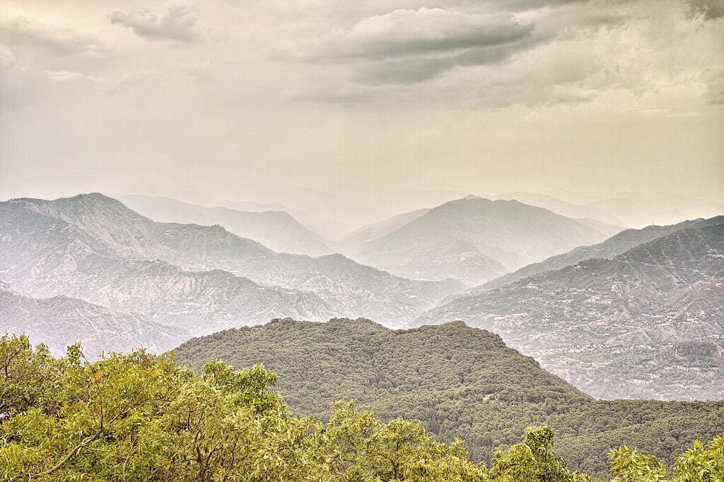
An easy 4.5-kilometre day trek. Climb through a fir and deodar forest and walk along the Dainkund ridge. The mountain range to the North is exceptionally photogenic.
This trek is child friendly, however, exercise caution at a couple of places along the Dainkund ridge. This day trek may be combined with various other treks that connect Dalhousie with Khajjiar, Chowari Jot and Chamba in Himachal Pradesh.
Table Of Contents
Trek Detail
The trek starts at Alha. Alha is a village, located 6 kilometres from Dalhousie G.P.O on the Dalhousie-Khajjiar Road. This village is accessible by bus (leaving for Khajjiar from Dalhousie) or by hitchhiking. Our day trek is divided into three distinct sections: a climb through a forest, a walk along the ridge and downhill along a concrete path. The starting point for the trek is the viewpoint on the Dalhousie-Khajjiar Road at Alha. From the viewpoint, the track bifurcates from the metalled road and leads to a foot trail. This wide foot trail winds uphill through a dense forest of fir and deodars. The woods, gently squeeze the trail and there will be times when you will be walking over, or between fallen trees.
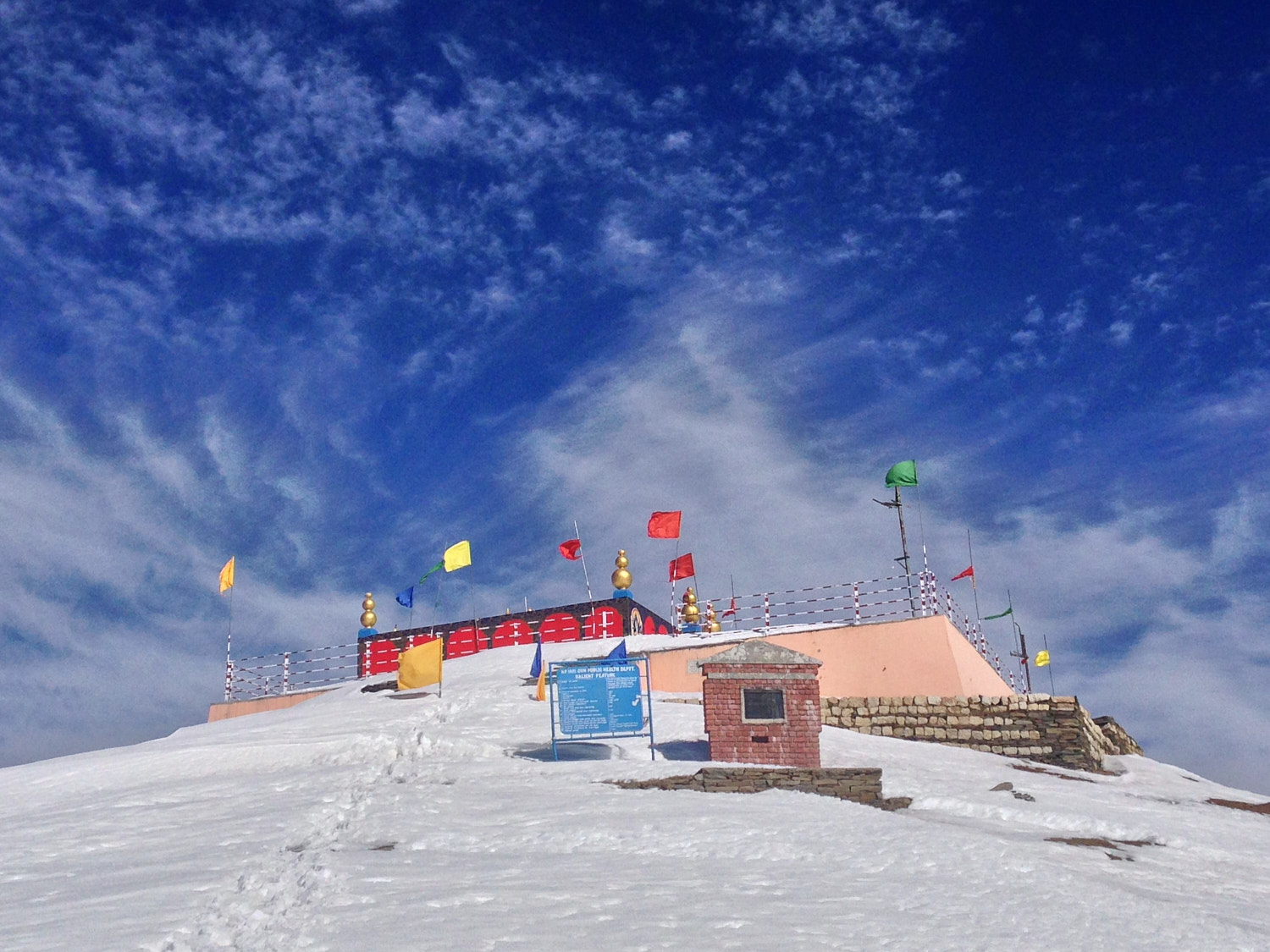
Small streams dot these woods, but, in November these streams had dried off. The trail climbs steadily for the next two kilometres and it exits the forest on a ridge near a tea shop. This shop is the right place to relax, and treat yourself to tea, “namkeen mattar” (Indian fried snack) and some piping hot “Besan Barfi” (Indian sweet made with gram flour and sugar). From the shop there is a well-marked one and a half kilometre trail along the ridge that leads from the shop to the viewpoint at Dainkund. This route is frequently used by locals to visit the Pholani Devi Temple and the trail winds along the outer wall of the Air Force Station. On this one and a half kilometre stretch, the elevation gain is minimal, however, the views from the ridge are mesmerising. At one end of the ridge are wooded hills that lead to Dalhousie, while on the other side the hills extend to tall snow-clad mountains. At a few places, the trail is squeezed between the ridge and the air force station’s outer wall. Take care while traversing these narrow sections, especially with children. The trail ends at a bifurcation near the Dainkund viewpoint. From Dainkund viewpoint, it is a comfortable 0.7 kilometre walk downhill to the vehicle parking lot over a concrete path.
Folklore has it that Dainkund (Dain=witch, kund=lake) was an abode for a powerful witch. She was slew by an incarnation of Kali Mata that arose at the site from a stone. The locals worship this incarnation as Pholani Mata.
Trek Summary
- Type - Day Trek. Easy and child-friendly.
- Difficulty - Swiss Alpine Club (SAC) Scale - T1.
- Hiking Time - 3 hours ascent, 2 hours descent.
- Hiking Distance - 4.5 kilometres.
- Maximum Elevation - 2751 metres.
- Starting Point - Alha village. 6 kilometres from Dalhousie G.P.O. on the Dalhousie-Khajjiar road (H.P.).
- Finishing Point - Dainkund , 5 kilometres from Lakkar Mandi, Dalhousie (H.P.).
- How to reach Dalhousie and Dainkund - Bus / Taxi / Hitchhiking
- Hotels and Stay - Hotels for every budget are available at Dalhousie. No accommodation at Dainkund. Expensive hotels at Khajjiar.
- Terrain - A gentle ascent over a well-marked trail
If you are at Dalhousie G.P.O on a Tuesday, make sure you savour the Madra Chawal at the Rehri Market near the Post Office (ask any local for directions). This roadside stall makes Madra only on Tuesdays and it is a quintessential Himachal dish that no tourist should leave without tasting.
Essential Gear
- Water is available at the tea shop and at Polani Devi temple. Though a liter bottle may come in handy.
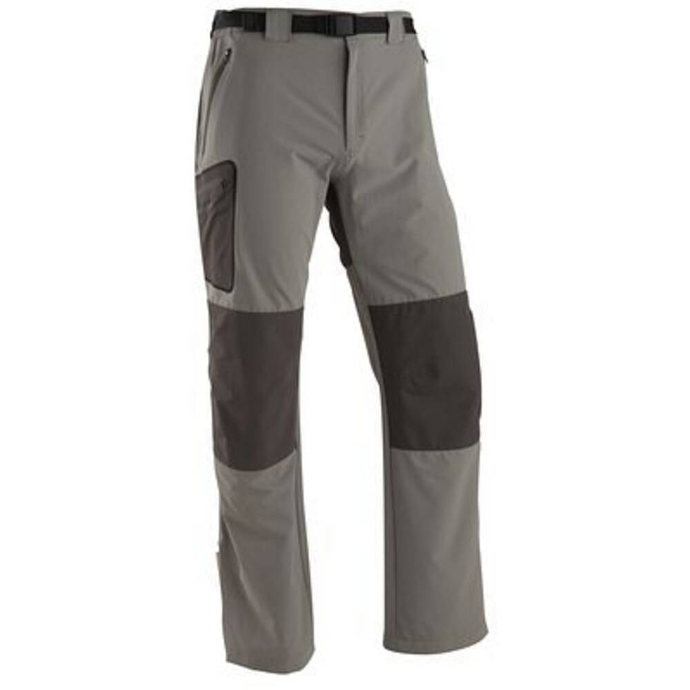
- Windproof jacket – for walking along the windy Dainkund ridge.
GPS Map, Waypoints & Log
Related
- This trek as an interactive map. Move your mouse pointer/finger over the elevation chart in the bottom right.